

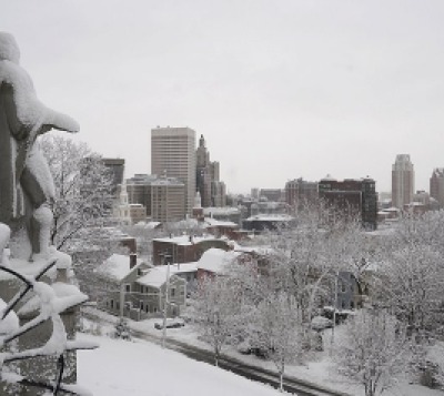
NEW: Winter Weather Advisory Issued for Providence, Up to 3 Inches of Snow Possible
GoLocalProv News Team
NEW: Winter Weather Advisory Issued for Providence, Up to 3 Inches of Snow Possible
The National Weather Service (NWS) has issued a Winter Weather Advisory for Providence which is set to take effect at 1 a.m. on Tuesday, December 17 and remains in effect until 1 p.m.
According to NWS, a total accumulation of three inches of snow is possible starting early Tuesday morning.
GET THE LATEST BREAKING NEWS HERE -- SIGN UP FOR GOLOCAL FREE DAILY EBLASTTonight
Snow, mainly after 2 a.m. New snow accumulation of around an inch possible.
Tuesday
Snow and sleet before 8 a.m, then freezing rain and sleet between 8 a.m. and 11 a.m., then rain and sleet after 11 a.m. New snow and sleet accumulation of 1 to 2 inches possible.
Tuesday Night
Rain, snow, freezing rain, and sleet likely before 10 p.m., then a chance of snow between 10 p.m. and 4 a.m. Little or no snow and sleet accumulation expected.
Read the Advisory Below
URGENT - WINTER WEATHER MESSAGE
National Weather Service Boston/Norton MA
344 AM EST Mon Dec 16 2019
MAZ007-013>021-RIZ002>007-161645-
/O.NEW.KBOX.WW.Y.0028.191217T0600Z-191217T1800Z/
Eastern Essex MA-Western Norfolk MA-Southeast Middlesex MA-
Suffolk MA-Eastern Norfolk MA-Northern Bristol MA-
Western Plymouth MA-Eastern Plymouth MA-Southern Bristol MA-
Southern Plymouth MA-Southeast Providence RI-Western Kent RI-
Eastern Kent RI-Bristol RI-Washington RI-Newport RI-
Including the cities of Gloucester, Foxborough, Norwood,
Cambridge, Boston, Quincy, Taunton, Brockton, Plymouth,
Fall River, New Bedford, Mattapoisett, Providence, Coventry,
West Greenwich, East Greenwich, Warwick, West Warwick, Bristol,
Narragansett, Westerly, and Newport
344 AM EST Mon Dec 16 2019
...WINTER WEATHER ADVISORY IN EFFECT FROM 1 AM TO 1 PM EST
TUESDAY...
* WHAT...Mixed precipitation expected. Total snow accumulations
of 1 to 3 inches and ice accumulations of a light glaze.
* WHERE...Mainly along and southeast of the Boston to Providence
corridor.
* WHEN...From 1 AM to 1 PM EST Tuesday.
* IMPACTS...Plan on slippery road conditions. The hazardous
conditions will impact the morning commute.
* ADDITIONAL DETAILS...Moderate to heavy snow is expected to be in
progress during the start of the Tuesday morning commute near
and especially south of the Massachusetts turnpike. The
precipitation will transition to a brief period of sleet and
freezing rain during the morning before a transition to all
rain.
PRECAUTIONARY/PREPAREDNESS ACTIONS...
Slow down and use caution while traveling.