

Snow Predicted for Much of Rhode Island Starting Sunday, 4+ Inches Possible in Providence
GoLocalProv News Team
Snow Predicted for Much of Rhode Island Starting Sunday, 4+ Inches Possible in Providence
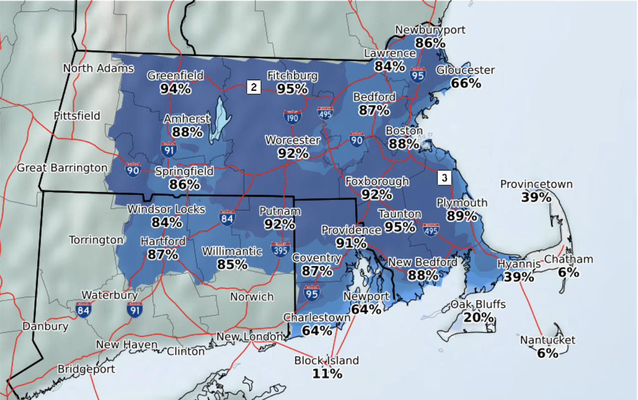
NWS posted a map Friday morning of southern New England showing the percent chance of 0.1” snow or more at 60% along the coast of southern Rhode Island and more than 90% inland, through Monday, December 2.
For Providence, new snow accumulation of 2-4 inches through Sunday night is possible.
GET THE LATEST BREAKING NEWS HERE -- SIGN UP FOR GOLOCAL FREE DAILY EBLASTThere is an additional chance of precipitation early next week.
For Providence
According to the NWS as of Friday morning, the forecast for Providence is as follows:
Saturday: Sunny, with a high near 38. Northwest wind 8 to 11 mph, with gusts as high as 23 mph.
Saturday Night: Mostly clear, with a low around 22. North wind 3 to 8 mph.
Sunday: Snow likely, possibly mixed with rain before 4pm, then snow. High near 36. Calm wind becoming east around 6 mph in the afternoon. Chance of precipitation is 80%. New snow accumulation of less than one inch possible.
Sunday Night: Rain, possibly mixed with snow, becoming all rain after 1am. Low around 32. Northeast wind 7 to 11 mph. Chance of precipitation is 100%. New snow accumulation of 2 to 4 inches possible.
Monday: Rain before 2pm, then rain likely, possibly mixed with snow. High near 37. North wind around 11 mph. Chance of precipitation is 90%.
Monday Night: A chance of rain and snow before midnight, then a chance of snow. Cloudy, with a low around 28. North wind around 11 mph. Chance of precipitation is 50%.
Precipitation is supposed to end by Tuesday.