

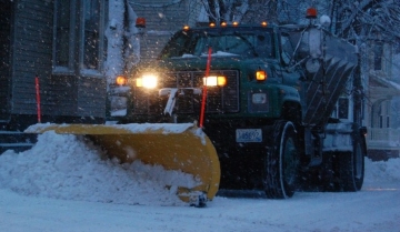
Ghiorse: 5 Inches of Snow Expected in RI From Winter Storm Wed.
John Ghiorse, GoLocalProv Meteorlogist
Ghiorse: 5 Inches of Snow Expected in RI From Winter Storm Wed.
Perhaps the most intense storm of this wild winter is taking shape this morning near the Gulf Stream just east of Florida. The storm will move rapidly northeastward today and swing by New England during the early part of tomorrow.
Meteorological "bomb"
GET THE LATEST BREAKING NEWS HERE -- SIGN UP FOR GOLOCAL FREE DAILY EBLASTIt's just a kitten now but it will become what is called a meteorological "bomb" as it deepens rapidly later today.
Of course, as with most storms, the track of the center of low pressure is most important and with this one it looks like it will be just far enough away from Rhode Island to spare us its worst affects ... heavy, wet snow and near hurricane force winds ... that may happen over the Cape and Islands.
The rule of thumb with this storm is, the farther west you go, the weaker the affects from the storm. So Western and Northern New England should escape with very little.
The estimate is for snow to begin in New England tonight and taper late tomorrow morning with 2"-5" possible in Rhode Island, a bit less in the Worcester area and more over Southeastern Massachusetts.
The Cape and Islands could see a foot in some spots. I caution that any jog in the track of as little as 50 miles or so could change things greatly and require a major change in the forecast, more if closer and less if farther away.
From the National Weather Service:
Hazardous Weather Outlook
HAZARDOUS WEATHER OUTLOOK
NATIONAL WEATHER SERVICE TAUNTON MA
418 AM EDT TUE MAR 25 2014
CTZ002>004-MAZ002>016-026-NHZ011-012-015-RIZ001>006-008-260830-
HARTFORD CT-TOLLAND CT-WINDHAM CT-WESTERN FRANKLIN MA-
EASTERN FRANKLIN MA-NORTHERN WORCESTER MA-CENTRAL MIDDLESEX MA-
WESTERN ESSEX MA-EASTERN ESSEX MA-WESTERN HAMPSHIRE MA-
WESTERN HAMPDEN MA-EASTERN HAMPSHIRE MA-EASTERN HAMPDEN MA-
SOUTHERN WORCESTER MA-WESTERN NORFOLK MA-SOUTHEAST MIDDLESEX MA-
SUFFOLK MA-EASTERN NORFOLK MA-NORTHERN MIDDLESEX MA-CHESHIRE NH-
EASTERN HILLSBOROUGH NH-WESTERN AND CENTRAL HILLSBOROUGH NH-
NORTHWEST PROVIDENCE RI-SOUTHEAST PROVIDENCE RI-WESTERN KENT RI-
EASTERN KENT RI-BRISTOL RI-WASHINGTON RI-BLOCK ISLAND RI-
418 AM EDT TUE MAR 25 2014
THIS HAZARDOUS WEATHER OUTLOOK IS FOR NORTHERN CONNECTICUT...
CENTRAL MASSACHUSETTS...EASTERN MASSACHUSETTS...NORTHEASTERN
MASSACHUSETTS...WESTERN MASSACHUSETTS...SOUTHERN NEW
HAMPSHIRE...NORTHERN RHODE ISLAND AND SOUTHERN RHODE ISLAND.
.DAY ONE...TODAY AND TONIGHT.
A VERY POWERFUL STORM WILL DEVELOP WELL OFFSHORE LATER TODAY. AT
THIS TIME IT LOOKS LIKE MOST OF THE IMPACT FROM THIS STORM WILL
OVER SOUTHEAST MASSACHUSETTS AND SOUTHEAST RHODE ISLAND TONIGHT
INTO WEDNESDAY. HOWEVER...THERE IS A LOW PROBABILITY THAT IF THE
TRACK SHIFTS A BIT TOO THE WEST... SIGNIFICANT SNOWFALL COULD
REACH AS FAR WEST AS THE BOSTON TO PROVIDENCE CORRIDOR.
.DAYS TWO THROUGH SEVEN...WEDNESDAY THROUGH MONDAY.
A VERY POWERFUL STORM WILL DEVELOP WELL OFFSHORE LATER TODAY. AT
THIS TIME IT LOOKS LIKE MOST OF THE IMPACT FROM THIS STORM WILL
OVER SOUTHEAST MASSACHUSETTS AND SOUTHEAST RHODE ISLAND TONIGHT
INTO WEDNESDAY. HOWEVER...THERE IS A LOW PROBABILITY THAT IF THE
TRACK SHIFTS A BIT TOO THE WEST... SIGNIFICANT SNOWFALL COULD
REACH AS FAR WEST AS THE BOSTON TO PROVIDENCE CORRIDOR.
.SPOTTER INFORMATION STATEMENT...
SPOTTER ACTIVATION WILL LIKELY BE NEEDED.
$$
Top 10 Blizzards in RI History

10. Blizzard of 2010
Max Accumulation: Approximately 13"
December 26-27, 2010
This winter storm brought more than a foot of snow to several parts of Rhode Island, including 13 inches in Woonsocket.

9. Blizzard of 2003
Max Accumulation: Approximately 15"
February 14-19, 2013
Know as the President’s Day Storm II, this blizzard brought roughly 15 inches to Ocean State.

8. Blizzard of 2009
Max Accumulation: Approximately 16"
December 16-20, 2009
Blizzard warnings were in effect in southern Rhode Island when this storm hit just before Christmas 2009.

7. April Fool's Day Blizzard
Max Accumulation: Approximately 18"
March 30 to April 1, 1997
This blizzard was no joke when it dropped 18 inches of snow in Providence.

6. 1969 Nor’easter
Max Accumulation: Approximately 20"
February 8-10, 1969
This storm blanketed many parts of Rhode Island with upwards of 20 inches of snow.

5. Great Blizzard of 1888
Max Accumulation: Approximately 20"
March 11-14, 1888
One of the most severe recorded blizzards in the history of the United States, this superstorm dumped 20 inches in Kingston.

4. Blizzard of 1996
Max Accumulation: Approximately 23"
Jan. 6-10, 1996
One of two blizzards to receive an “extreme” rating on the Northeast Snowfall Impact Scale, this storm blanketing parts of Rhode Island with upwards of 23 inches of snow.

3. Blizzard of 2005
Max Accumulation: Approximately 23.5"
January 20-23, 2005
This three-day storm delivered more nearly two feet of snow to some parts of Rhode Island.

2. Winter Storm Nemo
Max Accumulation: Approximately 24"
February 7-18, 2013
About 180,000 RI homes and businesses lost power during this powerful blizzard.

1. Blizzard of 1978
Max Accumulation: Approximately 38"
February 5-7, 1978
This historic nor’easter, which claimed the lives of 26 Rhode Islanders, brought a record-breaking 27.6 inches of snow to Providence and 38 inches to Woonsocket.


