Southern New England should begin to feel the outer fringe affects from Sandy by later today in the form of scattered light showers and a freshening northeasterly breeze. But the real action should begin later tonight and build during the day tomorrow. So you still have a good deal of time to prepare if you haven’t already done so.
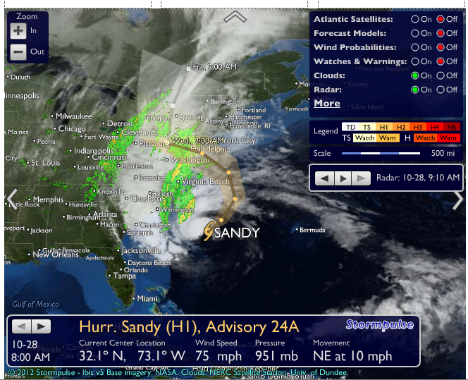
Early this morning Sandy was located just under 700 miles south-southwest of Providence, moving northeast around 10 or 12 MPH. Most of the weather forecasting mathematical models have consolidated on a track that will continue to move Sandy on its current course today will a gradual turn to the left, toward the East Coast tomorrow. The eventually landfall of the center should be tomorrow night along the New Jersey coast.
It looks like we can expect to see wind gusts in the range of 40-70 mph much of the day tomorrow along with severe coastal and beach battering. Widespread power outages are likely. A tidal storm surge of 3-5 feet late tomorrow and tomorrow evening likely will cause considerable flooding along the coast and around Narragansett Bay. We will see bands of heavy rain but the heaviest rain should occur to our west through New York and New Jersey.
This will be a long-duration storm and I will continue to have updates throughout the storm
Enjoy this post? Share it with others.
Translation service unavailable. Please try again later.