

Strong to Severe Storms Expected Monday - "Oppressive Heat" in Forecast Midweek
GoLocalProv News Team
Strong to Severe Storms Expected Monday - "Oppressive Heat" in Forecast Midweek
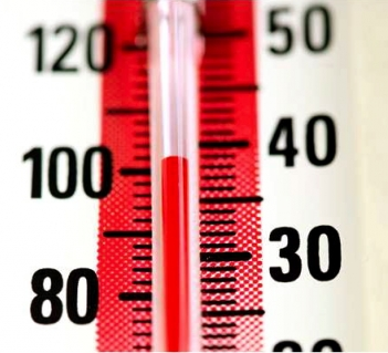
According to NWS, strong to severe storms are expected Monday -- with "oppressive heat" and heat index values ranging from 90 to 100 starting Tuesday.
Hazardous Weather Outlook
National Weather Service Boston/Norton MA
510 AM EDT Mon Jul 18 2022
CTZ002>004-MAZ002>024-026-RIZ001>008-190915-
Hartford CT-Tolland CT-Windham CT-Western Franklin MA-
Eastern Franklin MA-Northern Worcester MA-Central Middlesex MA-
Western Essex MA-Eastern Essex MA-Western Hampshire MA-
Western Hampden MA-Eastern Hampshire MA-Eastern Hampden MA-
Southern Worcester MA-Western Norfolk MA-Southeast Middlesex MA-
Suffolk MA-Eastern Norfolk MA-Northern Bristol MA-
Western Plymouth MA-Eastern Plymouth MA-Southern Bristol MA-
Southern Plymouth MA-Barnstable MA-Dukes MA-Nantucket MA-
Northern Middlesex MA-Northwest Providence RI-
Southeast Providence RI-Western Kent RI-Eastern Kent RI-Bristol RI-
Washington RI-Newport RI-Block Island RI-
510 AM EDT Mon Jul 18 2022
This Hazardous Weather Outlook is for northern Connecticut, all of
Massachusetts east of Berkshire County, and Rhode Island.
.DAY ONE...Today and tonight.
Numerous showers and scattered thunderstorms expected today into
tonight, especially across the interior. Strong to severe storms are
possible with the main risk of damaging wind gusts and locally heavy
downpours. A brief isolated tornado cannot completely be ruled out.
The risk of strong to severe storms is highest from noon to 10 PM.
.DAYS TWO THROUGH SEVEN...Tuesday through Sunday.
Oppressive heat possible Tuesday to Thursday due to increasing
humidity and temperatures. Heat Index values range from 90 to 100
away from the Islands Tuesday to Thursday. The peak of the heat is on
Wednesday and Thursday.
.SPOTTER INFORMATION STATEMENT...
Weather spotters are encouraged to report significant weather
conditions according to Standard Operating Procedures.