
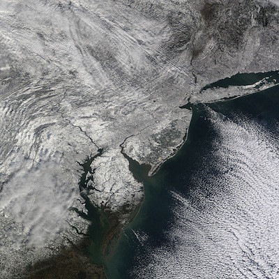
Storm Update: Mix of Sleet + Snow to Continue Through Afternoon
Wednesday, February 05, 2014
The heavy snow of early this morning has been transitioning over to sleet, freezing rain and rain from south to north across Rhode Island and this process will continue through the afternoon. It's a messy situation but typical of many winter storms we get here in Southern New England.

The precipitation may go back to all snow later today or this evening but by that time most of the heavy precipitation will be out of the area. So I wouldn't expect more than an additional inch or two before it all comes to an end later tonight.
National Weather Service
.LOW PRESSURE MOVING FROM THE MID-ATLANTIC THIS MORNING WILL
TRACK SOUTH OF NANTUCKET LATE TODAY. THIS STORM WILL BRING A
LARGE SWATH OF 6 TO 12 INCHES OF SNOWFALL AWAY FROM THE SOUTH
COAST. FOR THE IMMEDIATE SOUTH COAST OF MASSACHUSETTS AND RHODE
ISLAND...3 TO 6 INCHES OF SNOW ARE EXPECTED BEFORE A CHANGEOVER TO
SLEET AND RAIN FROM 9 AM TO MIDDAY. SNOW WILL TAPER OFF DURING THE
AFTERNOON EXCEPT ACROSS NORTHERN MASSACHUSETTS AND SOUTHWEST NEW
HAMPSHIRE WHERE SNOW MAY LINGER UNTIL THE EVENING.
...WINTER STORM WARNING REMAINS IN EFFECT UNTIL 6 PM EST THIS
EVENING...
* LOCATION...SOUTHERN NEW HAMPSHIRE...MOST OF MASSACHUSETTS AS
WELL AS NORTHERN CONNECTICUT AND RHODE ISLAND.
* TIMING...SNOW IS BEGINNING TO OVERSPREAD THE REGION THIS MORNING
AND IS EXPECTED TO BECOME HEAVY BY 6 OR 7 AM. SNOWFALL RATES OF
1 TO 2 INCHES PER HOUR ARE ANTICIPATED THROUGH MIDDAY BEFORE
TAPERING OFF DURING THE AFTERNOON.
* ACCUMULATIONS...SNOW ACCUMULATION OF 8 TO 12 INCHES...ALONG
WITH AROUND A TRACE OF ICE IN SPOTS.
* IMPACTS...DIFFICULT TRAVEL CONDITIONS AND REDUCED VISIBILITIES
DUE TO HEAVY SNOW AND SNOW COVERED ROADS...ESPECIALLY FOR THIS
MORNINGS COMMUTE.
* WINDS...NORTHEAST 10 TO 15 MPH WITH GUSTS UP TO 20 MPH.
* VISIBILITIES...ONE QUARTER MILE OR LESS AT TIMES.
* TEMPERATURES...IN THE UPPER 20S.
PRECAUTIONARY/PREPAREDNESS ACTIONS...
A WINTER STORM WARNING IS ISSUED WHEN AN AVERAGE OF 6 OR MORE
INCHES OF SNOW IS EXPECTED IN A 12 HOUR PERIOD...OR FOR 8 OR MORE
INCHES IN A 24 HOUR PERIOD. TRAVEL WILL BE SLOW AT BEST ON WELL
TREATED SURFACES...AND QUITE DIFFICULT ON ANY UNPLOWED OR
UNTREATED SURFACES.
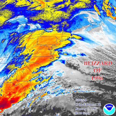
Related Slideshow: Top 10 Blizzards in RI History

.png)


_80_80_c1.png)


Related Articles
- NEW: Brown University to Cancel Classes Friday Due to Blizzard
- AM WEATHER UPDATE: Blizzard May Bring Up to 3 Feet of Snow
- GoLocal’s Readers’ Rhode Island Blizzard Photos
- AM WEATHER UDPATE: The Blizzard of ‘13 Not Over—Prepare For More Snow
- The 10 Greatest Blizzards in Rhode Island History
- Blizzard of 2010: Municipal Budget Buster
- PM WEATHER UPDATE: Blizzard Watch For RI, 1-2 Feet of Snow
- Blizzard is Here: Midnight Ghiorse Update
- AM WEATHER UPDATE: Blizzard Watch Expands—Hitting RI Friday AM
- Email Us Your Best Picture of the Blizzard
- NEW: Providence Restaurants That Are OPEN During the Blizzard
