

Tropical Storm Warning in Effect for RI for Next 36 Hours as Isaias Comes Up East Coast
GoLocalProv News Team
Tropical Storm Warning in Effect for RI for Next 36 Hours as Isaias Comes Up East Coast
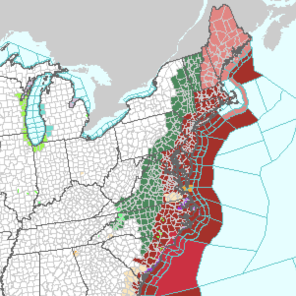
As Isaias makes its way up the east coast, NWS is warning of "tropical storm" force winds over the next 36 hours.
SEE WARNING BELOW
GET THE LATEST BREAKING NEWS HERE -- SIGN UP FOR GOLOCAL FREE DAILY EBLASTPeak winds of 20-30 miles per hour with gusts up to 45 miles per hour are possible.
"Isaias is forecast to make landfall tonight in the Carolinas with dangerous storm surge, flash flooding, damaging winds, and isolated tropical tornadoes," writes NWS.
"Isaias may strengthen briefly prior to landfall, but the impacts will be the same regardless of the categorical definition," NWS continued. "Isaias impacts will be felt all along the East Coast as Isaias moves northward through mid-week."
Get the latest on the news here -- sign up now
Tropical Storm Warning
Isaias Local Watch/Warning Statement/Advisory Number 26
National Weather Service Boston/Norton MA AL092020
1111 AM EDT Mon Aug 3 2020
Southeast Providence RI --
...TROPICAL STORM WARNING IN EFFECT...
A Tropical Storm Warning means tropical storm-force winds are
expected somewhere within this area within the next 36 hours
* LOCATIONS AFFECTED
- Providence
* WIND
- LATEST LOCAL FORECAST: Tropical storm force winds remain
possible
- Peak Wind Forecast: 20-30 mph with gusts to 45 mph
- THREAT TO LIFE AND PROPERTY THAT INCLUDES TYPICAL FORECAST
UNCERTAINTY IN TRACK, SIZE AND INTENSITY: Potential for wind 39
to 57 mph
- The wind threat has remained nearly steady from the
previous assessment.
- PLAN: Plan for hazardous wind of equivalent tropical storm
force.
- PREPARE: Efforts to protect property should now be
underway. Prepare for limited wind damage.
- ACT: Act now to complete preparations before the wind
becomes hazardous.
- POTENTIAL IMPACTS: Limited
- Damage to porches, awnings, carports, sheds, and unanchored
mobile homes. Unsecured lightweight objects blown about.
- Many large tree limbs broken off. A few trees snapped or
uprooted, but with greater numbers in places where trees
are shallow rooted. Some fences and roadway signs blown
over.
- A few roads impassable from debris, particularly within
urban or heavily wooded places. Hazardous driving
conditions on bridges and other elevated roadways.
- Scattered power and communications outages.
* STORM SURGE
- No storm surge inundation forecast
- THREAT TO LIFE AND PROPERTY THAT INCLUDES TYPICAL FORECAST
UNCERTAINTY IN TRACK, SIZE AND INTENSITY: Little to no storm
surge flooding
- The storm surge threat has remained nearly steady from the
previous assessment.
- PLAN: There is little to no threat of storm surge flooding.
Rough surf, coastal erosion, and life-threatening rip
currents are possible.
- PREPARE: Little to no preparations for storm surge flooding
are needed.
- ACT: Follow the instructions of local officials. Monitor
forecasts.
- POTENTIAL IMPACTS: Little to None
- Little to no potential impacts from storm surge flooding.
* FLOODING RAIN
- LATEST LOCAL FORECAST:
- Peak Rainfall Amounts: 1-3 inches, with locally higher
amounts
- THREAT TO LIFE AND PROPERTY THAT INCLUDES TYPICAL FORECAST
UNCERTAINTY IN TRACK, SIZE AND INTENSITY: Potential for
localized flooding rain
- The flooding rain threat has remained nearly steady from
the previous assessment.
- PLAN: Emergency plans should include the potential for
localized flooding from heavy rain.
- PREPARE: Consider protective actions if you are in an area
vulnerable to flooding.
- ACT: Heed any flood watches and warnings.
- POTENTIAL IMPACTS: Limited
- Localized rainfall flooding may prompt a few evacuations.
- Rivers and tributaries may quickly rise with swifter
currents. Small streams, creeks, and ditches may become
swollen and overflow in spots.
- Flood waters can enter a few structures, especially in
usually vulnerable spots. A few places where rapid ponding
of water occurs at underpasses, low-lying spots, and poor
drainage areas. Several storm drains and retention ponds
become near-full and begin to overflow. Some brief road and
bridge closures.
* TORNADO
- LATEST LOCAL FORECAST:
- Situation is somewhat favorable for tornadoes
- THREAT TO LIFE AND PROPERTY THAT INCLUDES TYPICAL FORECAST
UNCERTAINTY IN TRACK, SIZE AND INTENSITY: Potential for a few
tornadoes
- The tornado threat has remained nearly steady from the
previous assessment.
- PLAN: Emergency plans should include the potential for a
few tornadoes.
- PREPARE: If your shelter is particularly vulnerable to
tornadoes, prepare to relocate to safe shelter before
hazardous weather arrives.
- ACT: If a tornado warning is issued, be ready to shelter
quickly.
- POTENTIAL IMPACTS: Limited
- The occurrence of isolated tornadoes can hinder the
execution of emergency plans during tropical events.
- A few places may experience tornado damage, along with
power and communications disruptions.
- Locations could realize roofs peeled off buildings,
chimneys toppled, mobile homes pushed off foundations or
overturned, large tree tops and branches snapped off,
shallow-rooted trees knocked over, moving vehicles blown
off roads, and small boats pulled from moorings.
* FOR MORE INFORMATION:
- https://www.weather.gov/box