

New Storm Update: Snowfall Accumulation for RI - 4 to 7 Inches for Providence and North
GoLocalProv News Team
New Storm Update: Snowfall Accumulation for RI - 4 to 7 Inches for Providence and North
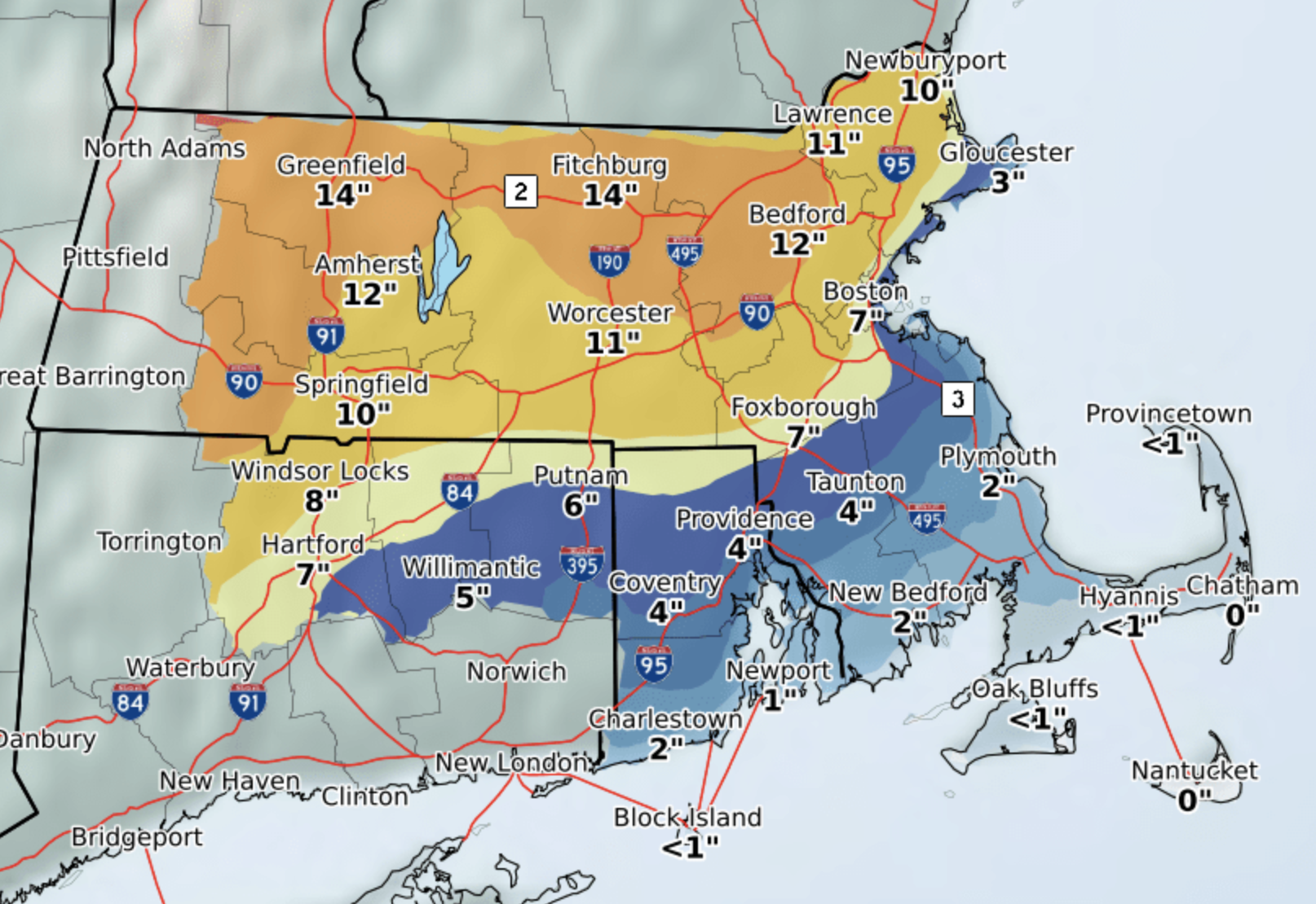
The lastest map published by NWS early Saturday morning shows predicted snowfall amounts of an inch or less along the coast, to four inches in Providence, to up to seven inches in northern Rhode Island over the period.
In addition, the NWS issued a Hazardous Weather Outlook for Rhode Island.
GET THE LATEST BREAKING NEWS HERE -- SIGN UP FOR GOLOCAL FREE DAILY EBLASTHazardous Weather Outlook
Hazardous Weather Outlook
National Weather Service Boston/Norton MA
451 AM EST Sat Nov 30 2019
CTZ004-MAZ017>024-RIZ001>008-011000-
Windham CT-Northern Bristol MA-Western Plymouth MA-
Eastern Plymouth MA-Southern Bristol MA-Southern Plymouth MA-
Barnstable MA-Dukes MA-Nantucket MA-Northwest Providence RI-
Southeast Providence RI-Western Kent RI-Eastern Kent RI-Bristol RI-
Washington RI-Newport RI-Block Island RI-
451 AM EST Sat Nov 30 2019
This Hazardous Weather Outlook is for northern Connecticut,
southeastern Massachusetts, and Rhode Island.
.DAY ONE...Today and tonight.
Hazardous weather is not expected at this time.
.DAYS TWO THROUGH SEVEN...Sunday through Friday.
A coastal storm will bring potential for accumulating snowfall
accompanied by a wintry mix of precipitation during Sunday through
early Tuesday.
.SPOTTER INFORMATION STATEMENT...
Weather spotters are encouraged to report significant weather
conditions according to Standard Operating Procedures.