RIPTA To Suspend Service at 5pm Sunday
Sunday, February 15, 2015
GoLocalProv News Team
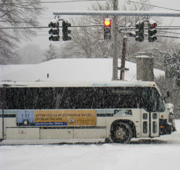
The Rhode Island Public Transit Authority (RIPTA) will start reducing service at 4pm on Sunday, February 15, with the intent of having all buses off the roads by 5 pm, due to the extreme cold, high winds, and drifting snow.
RIPTA officials said that buses will finish all service by 5 pm, with no new trips beginning after approximately 4 pm. The safety of passengers having to step into streets due to snow-blocked bus stops has been a concern throughout this severe winter and RIPTA officials said they do not want to compound the problem on a night the state is digging out after another major storm.
“RIPTA’s main concern is safety and weather officials are warning that frostbite can occur very quickly in these conditions,” said Barbara Polichetti, Director of Public Affairs for RIPTA. “We want to avoid having people waiting outside in the cold and the dark, particularly with wind-driven snow reducing visibility. We also want to keep roads clear as the state and its municipalities complete their snow removal efforts.”
GET THE LATEST BREAKING NEWS HERE -- SIGN UP FOR GOLOCAL FREE DAILY EBLAST
RIPTA officials noted that another factor in the decision to stop service early is the fact that ridership has been very light on all routes throughout the day. “The fact is that we are not moving many people right now, and we need to do what is best to be safe,” said Warwick Mayor Scott Avedisian, Chairman of RIPTA’s Board of Directors.
RIPTA is planning on resuming regular service on Monday, February 16, 2015. Although it is Presidents’ Day, RIPTA will be running regular weekday service.
PHOTO: zhelen/Flickr
Related Slideshow: Top 10 Blizzards in RI History
 View Larger +
Prev
Next
10. Blizzard of 2010
Max Accumulation: Approximately 13"
December 26-27, 2010
This winter storm brought more than a foot of snow to several parts of Rhode Island, including 13 inches in Woonsocket.
.png) View Larger +
View Larger +
Prev
Next
9. Blizzard of 2003
Max Accumulation: Approximately 15"
February 14-19, 2013
Know as the President’s Day Storm II, this blizzard brought roughly 15 inches to Ocean State.
 View Larger +
Prev
Next
8. Blizzard of 2009
Max Accumulation: Approximately 16"
December 16-20, 2009
Blizzard warnings were in effect in southern Rhode Island when this storm hit just before Christmas 2009.
 View Larger +
Prev
Next
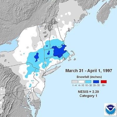
7. April Fool's Day Blizzard
Max Accumulation: Approximately 18"
March 30 to April 1, 1997
This blizzard was no joke when it dropped 18 inches of snow in Providence.
 View Larger +
Prev
Next
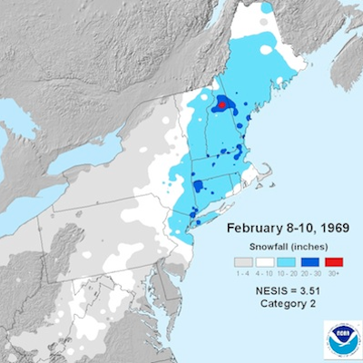
6. 1969 Nor’easter
Max Accumulation: Approximately 20"
February 8-10, 1969
This storm blanketed many parts of Rhode Island with upwards of 20 inches of snow.
 View Larger +
Prev
Next
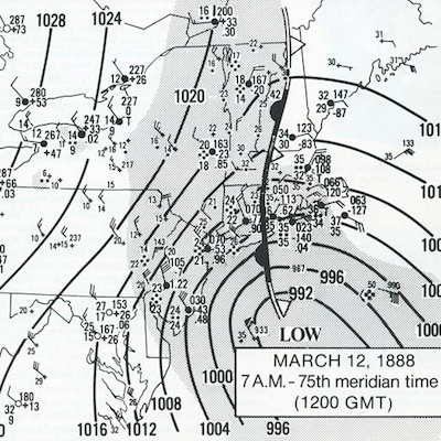
5. Great Blizzard of 1888
Max Accumulation: Approximately 20"
March 11-14, 1888
One of the most severe recorded blizzards in the history of the United States, this superstorm dumped 20 inches in Kingston.
 View Larger +
Prev
Next
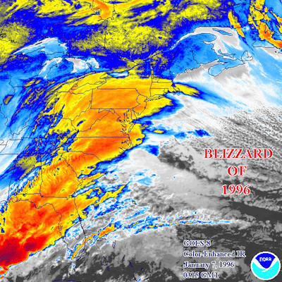
4. Blizzard of 1996
Max Accumulation: Approximately 23"
Jan. 6-10, 1996
One of two blizzards to receive an “extreme” rating on the Northeast Snowfall Impact Scale, this storm blanketing parts of Rhode Island with upwards of 23 inches of snow.
 View Larger +
Prev
Next
3. Blizzard of 2005
Max Accumulation: Approximately 23.5"
January 20-23, 2005
This three-day storm delivered more nearly two feet of snow to some parts of Rhode Island.
 View Larger +
Prev
Next
2. Winter Storm Nemo
Max Accumulation: Approximately 24"
February 7-18, 2013
About 180,000 RI homes and businesses lost power during this powerful blizzard.
 View Larger +
Prev
Next
1. Blizzard of 1978
Max Accumulation: Approximately 38"
February 5-7, 1978
This historic nor’easter, which claimed the lives of 26 Rhode Islanders, brought a record-breaking 27.6 inches of snow to Providence and 38 inches to Woonsocket.
Related Articles
Enjoy this post? Share it with others.



.png)
