
Winter Storm Watch: Up to 12 Inches + High Winds Expected Thurs.
Wednesday, February 12, 2014
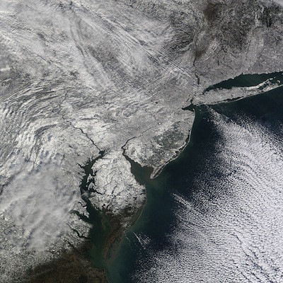
Southern New England can expect up to a foot of snow with wind gusts of up to 35 MPH starting Thursday morning.

The National Weather Service has issued a Winter Storm Watch for much of Southern New England, effective Thursday morning through Friday morning.
From the National Weather Service:
Winter Storm Watch
URGENT - WINTER WEATHER MESSAGE
NATIONAL WEATHER SERVICE TAUNTON MA
351 PM EST TUE FEB 11 2014
...STRONG WINTER STORM TO IMPACT SOUTHERN NEW ENGLAND EARLY
THURSDAY INTO FRIDAY MORNING...
MAZ002>006-008>013-026-NHZ011-012-015-120500-
/O.NEW.KBOX.WS.A.0005.140213T1200Z-140214T1200Z/
WESTERN FRANKLIN MA-EASTERN FRANKLIN MA-NORTHERN WORCESTER MA-
CENTRAL MIDDLESEX MA-WESTERN ESSEX MA-WESTERN HAMPSHIRE MA-
WESTERN HAMPDEN MA-EASTERN HAMPSHIRE MA-EASTERN HAMPDEN MA-
SOUTHERN WORCESTER MA-WESTERN NORFOLK MA-NORTHERN MIDDLESEX MA-
CHESHIRE NH-EASTERN HILLSBOROUGH NH-
WESTERN AND CENTRAL HILLSBOROUGH NH-
INCLUDING THE CITIES OF...CHARLEMONT...GREENFIELD...ORANGE...
BARRE...FITCHBURG...FRAMINGHAM...LOWELL...LAWRENCE...
CHESTERFIELD...BLANDFORD...AMHERST...NORTHAMPTON...SPRINGFIELD...
MILFORD...WORCESTER...FOXBORO...NORWOOD...AYER...JAFFREY...
KEENE...MANCHESTER...NASHUA...PETERBOROUGH...WEARE
351 PM EST TUE FEB 11 2014
...WINTER STORM WATCH IN EFFECT FROM THURSDAY MORNING THROUGH
FRIDAY MORNING...
THE NATIONAL WEATHER SERVICE IN TAUNTON HAS ISSUED A WINTER STORM
WATCH...WHICH IS IN EFFECT FROM THURSDAY MORNING THROUGH FRIDAY
MORNING.
* LOCATIONS...INCLUDE WESTERN...CENTRAL...EASTERN AND NORTHEASTERN
MASSACHUSETTS...AS WELL AS SOUTHERN NEW HAMPSHIRE.
* HAZARD TYPES...SNOW POSSIBLY MIXING WITH SLEET AND FREEZING RAIN
FOR AREAS ALONG A LINE FROM SPRINGFIELD TO WORCESTER MA
NORTHEAST TO MANCHESTER NH.
* ACCUMULATIONS...OF 8 TO 12 INCHES ARE POSSIBLE...ALONG WITH
AROUND A TRACE OF ICE. LOCALLY HIGHER AMOUNTS MAY FALL ALONG THE
EAST SLOPES OF HIGHER TERRAIN. SNOWFALL RATES OF 1 TO 2 INCHES
PER HOUR WILL BE POSSIBLE.
* TIMING...SNOW WILL BEGIN TO FALL AFTER MIDNIGHT THURSDAY PICKING
UP IN INTENSITY THROUGH THE DAY THURSDAY INTO THURSDAY NIGHT.
LOCATIONS AROUND SPRINGFIELD AND WORCESTER MA...TOWARDS
MANCHESTER NH MAY SEE A PERIOD OF A WINTRY MIX OF SLEET AND
FREEZING RAIN BEFORE CHANGING BACK TO SNOW.
* IMPACTS...VISIBILITIES DOWN TO A QUARTER MILE OR LESS WITH SNOW
ARE POSSIBLE. TRAVEL WILL BE DIFFICULT EARLY THURSDAY INTO
FRIDAY MORNING.
* WINDS...NORTHEAST 10 TO 20 MPH WITH GUSTS UP TO 35 MPH.
PRECAUTIONARY/PREPAREDNESS ACTIONS...
A WINTER STORM WATCH IS ISSUED FOR THE POTENTIAL OF ACCUMULATING
SNOW OF 6 OR MORE INCHES IN A 12 HOUR PERIOD...OR 8 OR MORE
INCHES IN A 24 HOUR PERIOD. ANYONE TRAVELING IN THE NEXT 24 TO
36 HOURS SHOULD MONITOR LATER FORECASTS AND BE PREPARED TO MODIFY TRAVEL PLANS SHOULD WINTER WEATHER DEVELOP.

.png)


_80_80_c1.png)


