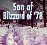
AM WEATHER UDPATE: The Blizzard of ‘13 Not Over—Prepare For More Snow
Saturday, February 09, 2013
As the sun comes up over Rhode Island, the Blizzard of '13 is still with us after a howling night of hurricane-force winds and driving snow.
The center of the Blizzard of ’13 will be just east of Cape Cod and Nantucket this morning and moving slowly away from the area during the day. The incredibly intense storm with whiteout snows and hurricane force wind gusts will wind down slowly as the day progresses. But snow bands will continue to dump a few more inches accumulation during the morning and perhaps early afternoon but at
a somewhat reduced rate over what occurred overnight. It still looks like the storm totals for snow accumulation will be on average around 2 feet, plus or minus 6 inches.Check the latest on RI's power outages, here.
Very cold air being drawn into the departing storm will keep readings well below freezing today with lows tonight expected to be in the single numbers to low teens. This may well create additional hardship for those without power. Sunshine is expected Sunday with highs reaching close to freezing.
GET THE LATEST BREAKING NEWS HERE -- SIGN UP FOR GOLOCAL FREE DAILY EBLASTTo see photos of the storm from GoLocalProv readers, go here.
Related Articles
- AM WEATHER UDPATE: The Blizzard of ‘13 Not Over—Prepare For More Snow
- NEW: Providence Restaurants That Are OPEN During the Blizzard
- AM WEATHER UPDATE: Blizzard May Bring Up to 3 Feet of Snow
- NEW: Storm Shuts Down Twin River
- LIVE MAP: Power Outages Across RI
- GoLocal Sports Gets Snowed In
- NEW: T.F. Greene, RIPTA Cancelling Service in Anticipation of Storm
- GoLocal’s Readers’ Rhode Island Blizzard Photos
- NEW: An Updated List of Today’s Cancellations
- NEW: Winter Storm Forcing School Closures, Postponements in RI
- The Blizzard of ‘13 Hits Providence
- NEW: Brown University to Cancel Classes Friday Due to Blizzard
- PM WEATHER UPDATE: Blizzard’s Most Intense Part Hitting RI Soon
- PM WEATHER UPDATE: RI’s Blizzard Watch Upgraded to Warning
- New England Meteorologists’ Blizzard Forecasts—Who Will Be Right?
- NEW: Chafee issues state of emergency: “Now is the time to hunker down”
- UPDATE: The Latest Storm Closings/Postponements in RI
- Rhode Island’s Biggest Storms: 75th Anniversary of Hurricane of ‘38
- NEW: Providence Parking Ban Begins at Noon, Mall Closing


