
NEW: RI May Get Up To 6 Inches Of Snow On Tuesday
Tuesday, February 18, 2014
It looks like today's snow event will turn out to be a little brother of some of the storms we've had this winter. Low pressure in the Eastern Great Lakes this morning will morph into an intensifying storm in the Gulf of Maine this evening. We will get caught on the fringe of the transition process and could see a brief period of heavier snow this afternoon. Some rain could mix in toward the coast. Any precipitation should end quickly this evening.

Snowfall totals will not be impressive ranging from 3"-6" over extreme Northwest Rhode Island, 2''-4" in the metro Providence area and less in and around Southern Rhode Island and Southeastern Massachusetts. The Worcester area may see 4"-8".
A few rain showers should usher in a modest "warm-up" beginning tomorrow and extending into the weekend. Look for it to be slushy and mushy underfoot for a few days as some of the fresh and old snow covers melts.
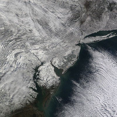
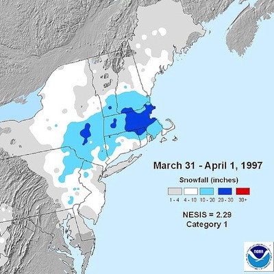
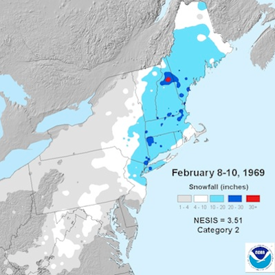
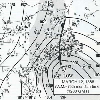
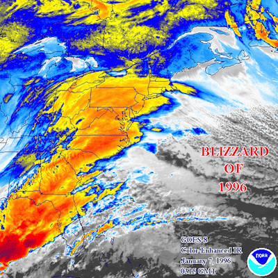
GET THE LATEST BREAKING NEWS HERE -- SIGN UP FOR GOLOCAL FREE DAILY EBLASTRelated Slideshow: Top 10 Blizzards in RI History

.png)

Related Articles
- College Admissions: Best Ski + Snowboard Colleges in the West
- National Grid, Fire Officials Urge For Safety in Snow Removal
- Leonard Moorehead, The Urban Gardener: Seeds in the Snowbed
- Getting Out: New England’s Best Snow Tubing Spots
- Newport Manners + Etiquette: Snow Shoveling Etiquette + More
- Leonard Moorehead, TheUrban Gardener: Snow is Good for Gardens
- Ghiorse Update - Providence May Get 12 Inches of Snow
- Organize + Energize: The Snowball Effect of Clutter
- WEATHER UPDATE: Snow Coming Tonight, Storm Outlook For Weekend
- How Did the City of Providence Do in Snow Removal?
- Providence Financial Giant Staggers Under Snowden Suits Fallout
- WEATHER UPDATE: Storm Will Dump Bulk of Heavy Snow Late Thursday
- 14 Great Snow Tubing Spots in New England
- NEW: More Snow Expected in RI This Weekend
- SUNDAY WEATHER UPDATE: Snow Tapering in RI, Biting Winds
- WEATHER UPDATE: Weekend Storm Bringing 3-6 Inches of Snow to RI
- AM WEATHER UDPATE: The Blizzard of ‘13 Not Over—Prepare For More Snow
- NEW: Weekend Storm Heading For RI—More Snow Possible
- Storm Update: Mix of Sleet + Snow to Continue Through Afternoon
- Brown University to Host Senator Olympia Snowe
- NEW: Weekend Storm Hitting RI Saturday Afternoon—Mixed Snow/Rain
- THURS AM WEATHER UPDATE: High Winds + Heavy Snow In RI Later Today
- College Admissions: Best Ski + Snowboard Colleges in the East
- NEW: Weekend Storm Intensifying, Could Bring More Snow To RI
- Urban Gardener: Paradise Survives Snowstorms!
