NEW: Providence Public Schools Issue Snow Cancellation for Monday February 8
Sunday, February 07, 2016
GoLocalProv News Team
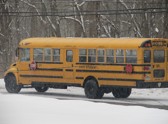
Providence Public Schools will be closed on Monday, February 8, in anticipation of storm that is expected to bring between six inches to a foot of snow in parts of Rhode Island.
Providence Public Schools tweeted the announcement on Sunday at 6 p.m. and added that administrative offices will be open.
GoLocal Meteorologist John Ghiorse reported Sunday:
GET THE LATEST BREAKING NEWS HERE -- SIGN UP FOR GOLOCAL FREE DAILY EBLAST
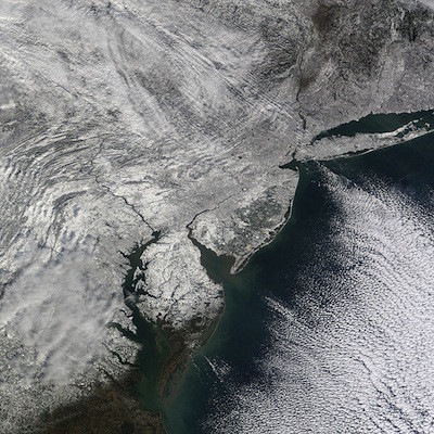
Here we go again. Another large ocean storm is moving up the coast and will likely take a track just far enough away from us to put us on the western edge of the heavy snow shield. As a forecaster that makes me very nervous since a small shift one way or the other can make a big difference in the eventual snow accumulation we end up with. A shift 50 miles to the east can mean a very light snowfall; shift 50 miles west and we get a lot more.
Right now it looks like the snow should begin within an hour or two of day break tomorrow and will likely get heavier during the morning and afternoon. Travel conditions should deteriorate rapidly as the snow intensifies. Strong, gusty northeast winds will cause much blowing and drifting. The heaviest snow should wind down tomorrow evening but snow showers will probably persist through the night.
Related Slideshow: Top 10 Blizzards in RI History
 View Larger +
Prev
Next
10. Blizzard of 2010
Max Accumulation: Approximately 13"
December 26-27, 2010
This winter storm brought more than a foot of snow to several parts of Rhode Island, including 13 inches in Woonsocket.
.png) View Larger +
View Larger +
Prev
Next
9. Blizzard of 2003
Max Accumulation: Approximately 15"
February 14-19, 2013
Know as the President’s Day Storm II, this blizzard brought roughly 15 inches to Ocean State.
 View Larger +
Prev
Next
8. Blizzard of 2009
Max Accumulation: Approximately 16"
December 16-20, 2009
Blizzard warnings were in effect in southern Rhode Island when this storm hit just before Christmas 2009.
 View Larger +
Prev
Next
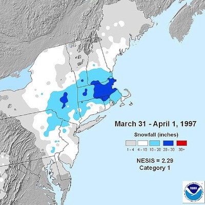
7. April Fool's Day Blizzard
Max Accumulation: Approximately 18"
March 30 to April 1, 1997
This blizzard was no joke when it dropped 18 inches of snow in Providence.
 View Larger +
Prev
Next
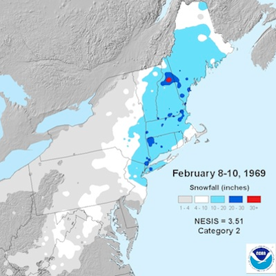
6. 1969 Nor’easter
Max Accumulation: Approximately 20"
February 8-10, 1969
This storm blanketed many parts of Rhode Island with upwards of 20 inches of snow.
 View Larger +
Prev
Next
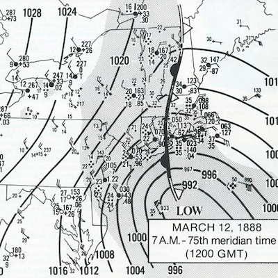
5. Great Blizzard of 1888
Max Accumulation: Approximately 20"
March 11-14, 1888
One of the most severe recorded blizzards in the history of the United States, this superstorm dumped 20 inches in Kingston.
 View Larger +
Prev
Next
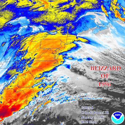
4. Blizzard of 1996
Max Accumulation: Approximately 23"
Jan. 6-10, 1996
One of two blizzards to receive an “extreme” rating on the Northeast Snowfall Impact Scale, this storm blanketing parts of Rhode Island with upwards of 23 inches of snow.
 View Larger +
Prev
Next
3. Blizzard of 2005
Max Accumulation: Approximately 23.5"
January 20-23, 2005
This three-day storm delivered more nearly two feet of snow to some parts of Rhode Island.
 View Larger +
Prev
Next
2. Winter Storm Nemo
Max Accumulation: Approximately 24"
February 7-18, 2013
About 180,000 RI homes and businesses lost power during this powerful blizzard.
 View Larger +
Prev
Next
1. Blizzard of 1978
Max Accumulation: Approximately 38"
February 5-7, 1978
This historic nor’easter, which claimed the lives of 26 Rhode Islanders, brought a record-breaking 27.6 inches of snow to Providence and 38 inches to Woonsocket.
Related Articles
Enjoy this post? Share it with others.


.png)


