Ghiorse: Winter Storm Thursday Midday Update
Thursday, February 13, 2014
John Ghiorse, GoLocalProv Meteorlogist
This storm still looks like a snow to sleet and rain situation for most of us. The storm centered over eastern North Carolina this morning will track very close to Cape Cod late tonight. With the changeover taking place gradually, first along the coast later this morning then progressing inland during the afternoon, heavy accumulated snow will become a slushy, slippery, sloppy mess by the evening commute.
Estimated snow accumulations before the changeover are upwards of a foot in the Worcester area, 6-10" in Northwestern Rhode Island, 4-8" in and around Providence then dropping off to 3-5" around Westerly and 2-4" in the Newport area. Those totals could get higher or lower depending on the timing of the change to sleet and rain. There could be a brief change back to lighter snow late tonight but any further accumulation would be light by comparison.
Related Slideshow: Top 10 Blizzards in RI History
 View Larger +
Prev
Next
10. Blizzard of 2010
Max Accumulation: Approximately 13"
December 26-27, 2010
This winter storm brought more than a foot of snow to several parts of Rhode Island, including 13 inches in Woonsocket.
.png) View Larger +
View Larger +
Prev
Next
9. Blizzard of 2003
Max Accumulation: Approximately 15"
February 14-19, 2013
Know as the President’s Day Storm II, this blizzard brought roughly 15 inches to Ocean State.
 View Larger +
Prev
Next
8. Blizzard of 2009
Max Accumulation: Approximately 16"
December 16-20, 2009
Blizzard warnings were in effect in southern Rhode Island when this storm hit just before Christmas 2009.
 View Larger +
Prev
Next
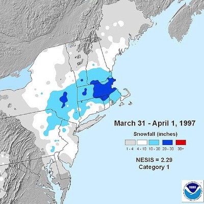
7. April Fool's Day Blizzard
Max Accumulation: Approximately 18"
March 30 to April 1, 1997
This blizzard was no joke when it dropped 18 inches of snow in Providence.
 View Larger +
Prev
Next
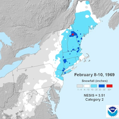
6. 1969 Nor’easter
Max Accumulation: Approximately 20"
February 8-10, 1969
This storm blanketed many parts of Rhode Island with upwards of 20 inches of snow.
 View Larger +
Prev
Next
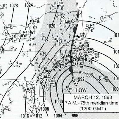
5. Great Blizzard of 1888
Max Accumulation: Approximately 20"
March 11-14, 1888
One of the most severe recorded blizzards in the history of the United States, this superstorm dumped 20 inches in Kingston.
 View Larger +
Prev
Next
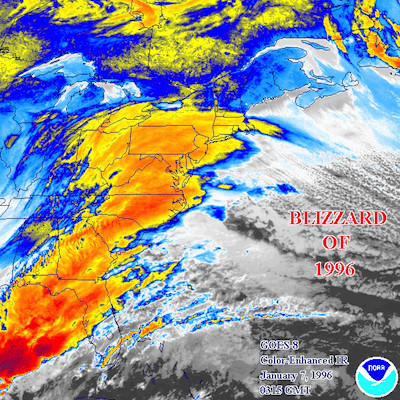
4. Blizzard of 1996
Max Accumulation: Approximately 23"
Jan. 6-10, 1996
One of two blizzards to receive an “extreme” rating on the Northeast Snowfall Impact Scale, this storm blanketing parts of Rhode Island with upwards of 23 inches of snow.
 View Larger +
Prev
Next
3. Blizzard of 2005
Max Accumulation: Approximately 23.5"
January 20-23, 2005
This three-day storm delivered more nearly two feet of snow to some parts of Rhode Island.
 View Larger +
Prev
Next
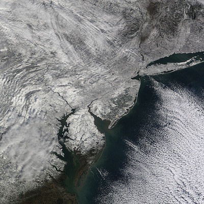
2. Winter Storm Nemo
Max Accumulation: Approximately 24"
February 7-18, 2013
About 180,000 RI homes and businesses lost power during this powerful blizzard.
 View Larger +
Prev
Next
1. Blizzard of 1978
Max Accumulation: Approximately 38"
February 5-7, 1978
This historic nor’easter, which claimed the lives of 26 Rhode Islanders, brought a record-breaking 27.6 inches of snow to Providence and 38 inches to Woonsocket.
Related Articles
Enjoy this post? Share it with others.


.png)


_80_80_c1.png)


