
Ghiorse: 5 Inches of Snow Expected in RI From Winter Storm Wed.
Tuesday, March 25, 2014
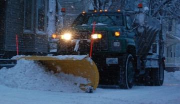
Rhode Island faces up to 5 inches of snow--with the possibility for more--with a winter storm expected to reach New England overnight Tuesday into Wednesday.
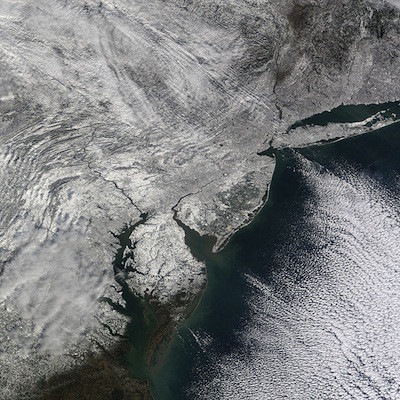
Perhaps the most intense storm of this wild winter is taking shape this morning near the Gulf Stream just east of Florida. The storm will move rapidly northeastward today and swing by New England during the early part of tomorrow.
Meteorological "bomb"
GET THE LATEST BREAKING NEWS HERE -- SIGN UP FOR GOLOCAL FREE DAILY EBLASTIt's just a kitten now but it will become what is called a meteorological "bomb" as it deepens rapidly later today.
Of course, as with most storms, the track of the center of low pressure is most important and with this one it looks like it will be just far enough away from Rhode Island to spare us its worst affects ... heavy, wet snow and near hurricane force winds ... that may happen over the Cape and Islands.
The rule of thumb with this storm is, the farther west you go, the weaker the affects from the storm. So Western and Northern New England should escape with very little.
The estimate is for snow to begin in New England tonight and taper late tomorrow morning with 2"-5" possible in Rhode Island, a bit less in the Worcester area and more over Southeastern Massachusetts.
The Cape and Islands could see a foot in some spots. I caution that any jog in the track of as little as 50 miles or so could change things greatly and require a major change in the forecast, more if closer and less if farther away.
From the National Weather Service:
Hazardous Weather Outlook
HAZARDOUS WEATHER OUTLOOK
NATIONAL WEATHER SERVICE TAUNTON MA
418 AM EDT TUE MAR 25 2014
CTZ002>004-MAZ002>016-026-NHZ011-012-015-RIZ001>006-008-260830-
HARTFORD CT-TOLLAND CT-WINDHAM CT-WESTERN FRANKLIN MA-
EASTERN FRANKLIN MA-NORTHERN WORCESTER MA-CENTRAL MIDDLESEX MA-
WESTERN ESSEX MA-EASTERN ESSEX MA-WESTERN HAMPSHIRE MA-
WESTERN HAMPDEN MA-EASTERN HAMPSHIRE MA-EASTERN HAMPDEN MA-
SOUTHERN WORCESTER MA-WESTERN NORFOLK MA-SOUTHEAST MIDDLESEX MA-
SUFFOLK MA-EASTERN NORFOLK MA-NORTHERN MIDDLESEX MA-CHESHIRE NH-
EASTERN HILLSBOROUGH NH-WESTERN AND CENTRAL HILLSBOROUGH NH-
NORTHWEST PROVIDENCE RI-SOUTHEAST PROVIDENCE RI-WESTERN KENT RI-
EASTERN KENT RI-BRISTOL RI-WASHINGTON RI-BLOCK ISLAND RI-
418 AM EDT TUE MAR 25 2014
THIS HAZARDOUS WEATHER OUTLOOK IS FOR NORTHERN CONNECTICUT...
CENTRAL MASSACHUSETTS...EASTERN MASSACHUSETTS...NORTHEASTERN
MASSACHUSETTS...WESTERN MASSACHUSETTS...SOUTHERN NEW
HAMPSHIRE...NORTHERN RHODE ISLAND AND SOUTHERN RHODE ISLAND.
.DAY ONE...TODAY AND TONIGHT.
A VERY POWERFUL STORM WILL DEVELOP WELL OFFSHORE LATER TODAY. AT
THIS TIME IT LOOKS LIKE MOST OF THE IMPACT FROM THIS STORM WILL
OVER SOUTHEAST MASSACHUSETTS AND SOUTHEAST RHODE ISLAND TONIGHT
INTO WEDNESDAY. HOWEVER...THERE IS A LOW PROBABILITY THAT IF THE
TRACK SHIFTS A BIT TOO THE WEST... SIGNIFICANT SNOWFALL COULD
REACH AS FAR WEST AS THE BOSTON TO PROVIDENCE CORRIDOR.
.DAYS TWO THROUGH SEVEN...WEDNESDAY THROUGH MONDAY.
A VERY POWERFUL STORM WILL DEVELOP WELL OFFSHORE LATER TODAY. AT
THIS TIME IT LOOKS LIKE MOST OF THE IMPACT FROM THIS STORM WILL
OVER SOUTHEAST MASSACHUSETTS AND SOUTHEAST RHODE ISLAND TONIGHT
INTO WEDNESDAY. HOWEVER...THERE IS A LOW PROBABILITY THAT IF THE
TRACK SHIFTS A BIT TOO THE WEST... SIGNIFICANT SNOWFALL COULD
REACH AS FAR WEST AS THE BOSTON TO PROVIDENCE CORRIDOR.
.SPOTTER INFORMATION STATEMENT...
SPOTTER ACTIVATION WILL LIKELY BE NEEDED.
$$
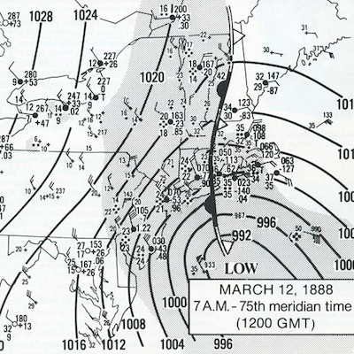
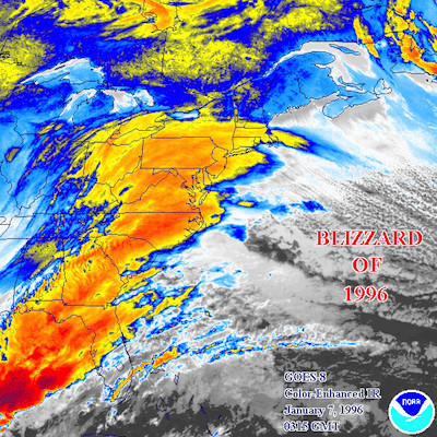
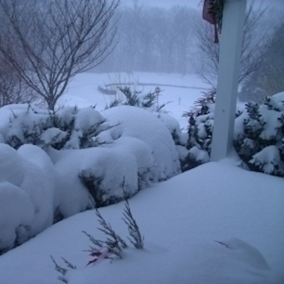
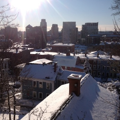
Related Slideshow: Top 10 Blizzards in RI History

.png)


_80_80_c1.png)


Related Articles
- Ghiorse Update - Providence May Get 12 Inches of Snow
- John Ghiorse: Blizzard Conditions Expected in RI Tuesday Afternoon
- NEW: Winter Storm Warning Issued, John Ghiorse Updates
- Ghiorse Update on Hurricane Earl: 1:45 pm
- John Ghiorse’s Latest Update On Hurricane Earl: THURSDAY AM
- THURSDAY 3PM: John Ghiorse’s Latest Update On Hurricane Earl
- Ghiorse’s 4th of July Weekend Forecast
- John Ghiorse’s Latest Update On Hurricane Earl: TUESDAY AM
- TUESDAY HURRICANE UPDATE: Ghiorse’s Latest, Outages + More
- Ghiorse: Winter Storm Thursday Midday Update
- John Ghiorse’s Update On Hurricane Earl: Wednesday Morning
- HURRICANE UPDATE MONDAY EVE: Ghiorse Says More High Winds, Flooding
- Just What Is The Ghiorse Factor Anyway?
- HURRICANE UPDATE: Monday Morning + John Ghiorse’s Outlook
- NEW: Ghiorse - Son of Sandy on the Way to New England
- How To Use The Ghiorse Factor
- NEW: John Ghiorse’s Winter Weather Update
- Hurricane Sandy Update from John Ghiorse
- NEW: Winter Storm Could Bring 12+ Inches, John Ghiorse Updates
