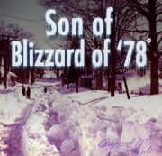
AM WEATHER UPDATE: Blizzard Watch Expands—Hitting RI Friday AM
Thursday, February 07, 2013
Friday's big blizzard is getting bigger, and is on track to hit Rhode Island with up to two feet of snow starting Friday morning, according to the latest data. The Blizzard Watch for Rhode Island has been expanded westward by the National Weather Service to now include Central and Eastern Connecticut and Central Massachusetts and eastward to include Cape Cod and the Islands. The Blizzard Watch continues posted for Rhode Island and the rest of Eastern Massachusetts.
Remarkably there has been little change in my thinking overnight as new data continues to pour in. The model prediction data has been very consistent and insistent on a major snowfall of 1-2 feet or so over most of the area. The one wild card I continue to see at this point is will there be a mix or change to sleet and rain during the middle of the storm Friday night and early Saturday and if it does occur, how far inland will it penetrate? Quite frankly there’s now way to know for sure until the storm gets underway.
I still see snow beginning here tomorrow morning, becoming heavier in the afternoon and evening and slowly winding down on Saturday. The peak snowfall intensity should occur Friday night and early Saturday morning. I will have another update this afternoon.
Here is the latest updated information from the National Weather Service:
THE NATIONAL WEATHER SERVICE IN TAUNTON HAS UPGRADED A WINTER STORM WATCH TO A BLIZZARD WATCH...WHICH IS IN EFFECT FROM FRIDAY MORNING THROUGH SATURDAY AFTERNOON. * LOCATIONS...SOUTHERN RHODE ISLAND...AS WELL AS THE SOUTH COAST OF MASSACHUSETTS AND SOUTHERN WORCESTER COUNTY MASSACHUSETTS. * HAZARD TYPES...HEAVY SNOW WITH POTENTIAL FOR BLIZZARD CONDITIONS. * ACCUMULATIONS...SNOW ACCUMULATION OF 18 TO 24 INCHES. * TIMING...LIGHT SNOW DEVELOPS BY FRIDAY MORNING. SNOW WILL INCREASE IN INTENSITY DURING FRIDAY AFTERNOON. THERE MAY BE A BRIEF CHANGE OVER TO RAIN ESPECIALLY NEAR THE SOUTH COAST DURING THE AFTERNOON. THE RAIN SHOULD SWITCH BACK TO HEAVY SNOW BY FRIDAY NIGHT AND SATURDAY MORNING...WHEN THE BULK OF THE STORM IS EXPECTED. * IMPACTS...HEAVY SNOW AND VERY STRONG WINDS WILL BRING THE POTENTIAL FOR BLIZZARD CONDITIONS. THE WORST OF THE STORM WILL BE FRIDAY NIGHT INTO SATURDAY MORNING. SNOWFALL RATES OF 2 TO 3 INCHES PER HOUR POSSIBLE. TRAVEL MAY BECOME NEARLY IMPOSSIBLE WITH BLOWING AND DRIFTING SNOW. * WINDS...NORTHEAST 25 TO 35 MPH WITH GUSTS UP TO 65 MPH. * VISIBILITIES...ONE QUARTER MILE OR LESS AT TIMES. PRECAUTIONARY/PREPAREDNESS ACTIONS... A BLIZZARD WATCH MEANS THERE IS A POTENTIAL FOR CONSIDERABLE FALLING AND/OR BLOWING SNOW WITH SUSTAINED WINDS OR FREQUENT GUSTS OVER 35 MPH AND VISIBILITIES BELOW 1/4 MILE FOR AT LEAST 3 HOURS. WHITEOUT CONDITIONS WILL BE POSSIBLE...MAKING TRAVEL VERY DANGEROUS. BE PREPARED TO ALTER ANY TRAVEL PLANS.
GET THE LATEST BREAKING NEWS HERE -- SIGN UP FOR GOLOCAL FREE DAILY EBLAST


